Using the FeatureTableWidget in GeoBlazor Pro
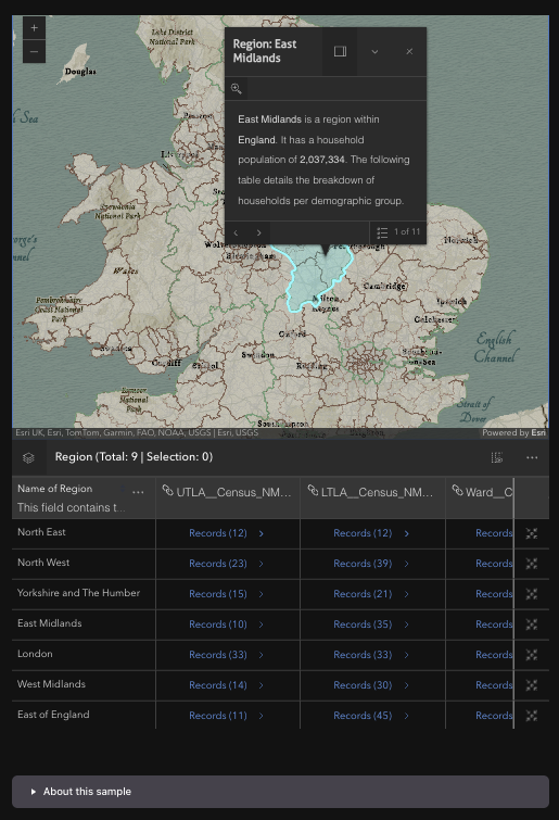
GeoBlazor Pro 4.5 introduced the FeatureTableWidget, an interactive attribute table for your map's feature layers. In this tutorial, we wire it up from scratch: binding a layer, filtering rows to the map extent, adding a zoom-to-feature action column, exploring related records, and highlighting features with a drawn geometry.